Here’s How Hurricane Lee Could Affect Maine & New Hampshire
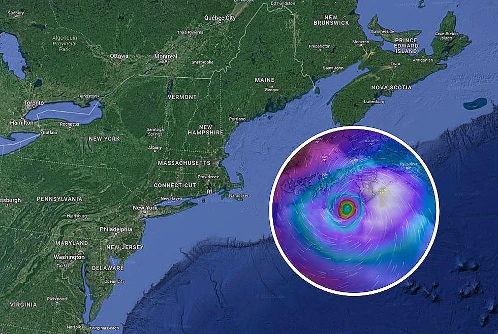
Late on Wednesday night, we got word that Tropical Storm Lee had been upgraded to hurricane status. Even though it is still way out in the ocean, there are some indications that it could be headed our way.
According to the meteorologists at News Center Maine, it is expected to be cruising south of Bermuda over the weekend. At that point, it is estimated that it will either be a category 4 or category 5 hurricane.
Some models have the hurricane continuing west (toward Florida) and then arcing north. If that happens, it means it could zip off the coast of New England. That means Maine, New Hampshire, Massachusetts, Connecticut, Rhode Island, etc could all feel the affects of the storm.

If it does end up continuing farther north, instead of hitting the Carolinas, we could see it impacting Cape Cod by the end of next week. Then, there is a chance that it could continue further north and bring rain and high winds to Maine and New Hampshire.
Currently, many meteorologists are keeping an eye on the situation. We'll have a much better idea of how the storm could affect us by early next week.
But, because the storm could come charging up the coast, it would be a good idea to have some precautions in place. This is especially true if you are on the coast. Have a little extra food stocked up, some extra bottled water on hand, and pick up some batteries for flashlights. Also, if you have a generator, make sure it is in good working order.
We'll be keeping an eye on this story and will bring you updates as they become available.
Your hurricane emergency kit: what to pack
Gallery Credit: Sophia Laico
More From Ultimate Weather